An interesting conundrum
Spending most of our time on each end of the Colorado River these days keeps us entrenched in a well-publicized and dire predicament for seven Western states. Drought.
I spent a lot of time last summer trying to organize a public event for my Friends Group – Friends of Bill Williams River & Havasu National Wildlife Refuges – along with Lake Havasu State Park, AZ Game & Fish, Corps of Engineers, to try to help local residents better understand the situation. In Lake Havasu, year after year you look out at the lake and it always looks the same. It’s easy to be lulled into belief that for some reason, we are not subject to what has already happened at Lake Powell and Lake Mead. And the truth is complicated:
- More water is released from Lake Mead and Lake Powell to supply demand, and
- California has the largest entitlements to these lakes, and
- Lake Havasu serves as a balancing reservoir.
A balancing reservoir in a water supply distribution system is to address the frequent fluctuations in the rate of consumption. To supply this, Lake Havasu does not vary more than five feet.
After many months of work, we shelved the project. It’s not that people don’t know, but, as I said, the truth is complicated. It’s complicated because if there is no water, there is no water, and Lake Havasu will be affected.
The Colorado River provides drinking water for more than 40 million people, hydroelectric power to meet the needs of over 7 million people, and water for 30 Native American Tribes. It irrigates around 5 million acres of fields that supply vegetables to the entire world and supports a thriving $26-billion recreation and tourism economy, as well as a wide variety of wildlife.
In August 2021, due to the low levels of water at Lake Mead, the federal government declared a Tier 1 water shortage in the Colorado River for the first time ever. These Arizona reductions will be borne by Central Arizona Project (CAP) water users. The result will be less available Colorado River water for central Arizona agriculture.
Computer models predict Lake Mead could drop below 1,050 feet by November 2022, triggering a Tier 2 shortage, under which Arizona would lose another 80,000 acre-feet and Nevada an additional 4,000. By July 2023, the furthest forecast in a 24-month study, the lake could drop to 1,038 feet, at which point California would take its first cut of 200,000 acre-feet.
See what I mean? It’s difficult to get a grasp on the enormity of this.
Meanwhile, back at Havasu Springs…
Our 2021-22 guided fishing season at HavasuNetEm.com was a huge success and is already just a blur in our memories. D.A. worked 190 days! He worked seven days a week, holidays and his birthday included. The only way he got time off was when the wind created unsafe conditions – and the customers did not like getting those calls. So if the Captain worked 190 days, his Chief Sidekick and Windshield Washer was working too. All I can say is bless my kayak and line-dancing communities for providing much needed respite.
On the road again
We moved from Havasu Springs to Lake Havasu City at the end of April for maintenance on the RV and boat – anxious to get on the road headed north as daily temps were nearing 100 degrees. Headed for Salt Lake City (on our way back to Buckboard), but we hadn’t made reservations in advance because we didn’t know what day our maintenance would be completed.
Thinking we would spend one night near St. George, we couldn’t find reservations for the coming days in the Salt Lake City area, so we spent a second night at Southern Utah RV Resort. This is a fairly new park, quite nice except it is located next to the I-15, so the road noise is constant. It’s definitely an upgrade from Temple View RV Park in St. George that I mentioned in a previous post.
While there however, we discovered a brand new park only about a mile away (a mile away from I-15!) which we will try when we are next in the area. It is Settler’s Point Luxury RV Resort.
We were scheduled to take the boat to Fred’s Marine in Layton (north of Salt Lake) for some wiring issues and installation of new electronics. We figured we would be in the Salt Lake area for a week or two, but we could not find accommodations. The Salt Lake area is really limited in parks. A couple of existing ones are affiliated with theme parks, which might be great for families, but not really interesting to us. We’d much prefer accessibility to the natural areas we always visit on our trips to the area: Antelope Island State Park (near Layton) and Bear River Migratory Bird Refuge (near Brigham City).
We ended up at Century RV Park & Campground in Ogden – a spot also previously mentioned in an earlier post, but this time our report is not quite as glowing as our last visit. This is because, since we were staying more than a week, they put us in one of the long-term sections. It had quite a different feel – not bad, just not as nice… and the low water pressure took some getting used to.
I scouted other possibilities here for future too and found a gorgeous spot just a few miles away in South Weber. Riverside RV Resort is also brand new and near Highway 84 (much less busy than I-15), and there’s a beautiful multi-use path adjacent to the property along the Weber River. Bingo! We’ll be back!!
While in Ogden, we discovered some new attractions
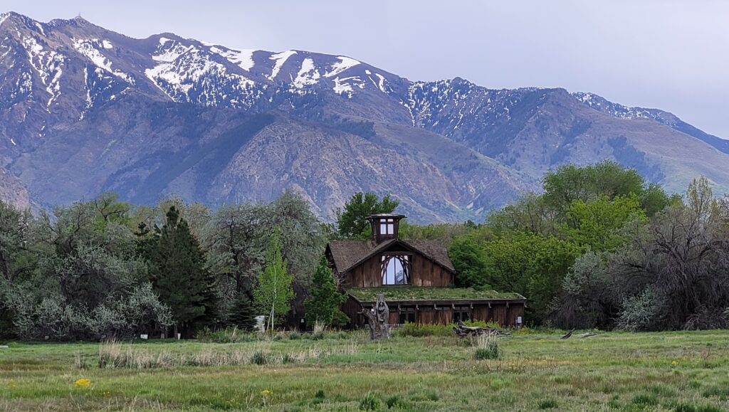
Ogden Nature Center – A 152-acre nature preserve and education center that offers a wide variety of activities from walking trails to educational programs for all ages.
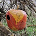
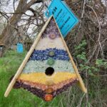
And a birdhouse competition was going on. These are not the winners, just a couple of my favorites.
Ogden Botanical Gardens – The mission of the Ogden Botanical Gardens is to promote inner-city beauty and educational opportunities for everyone in a diverse and sustainable garden setting. There are numerous gardens: Accessibility, Collections, Conifer, Cottage, Edible, Asian, Pollinator, Rose, Water Conservation, and Water-Wise Perennial! And it’s adjacent to the Ogden River Parkway Trail, so you can easily spend hours seeing all the sights.
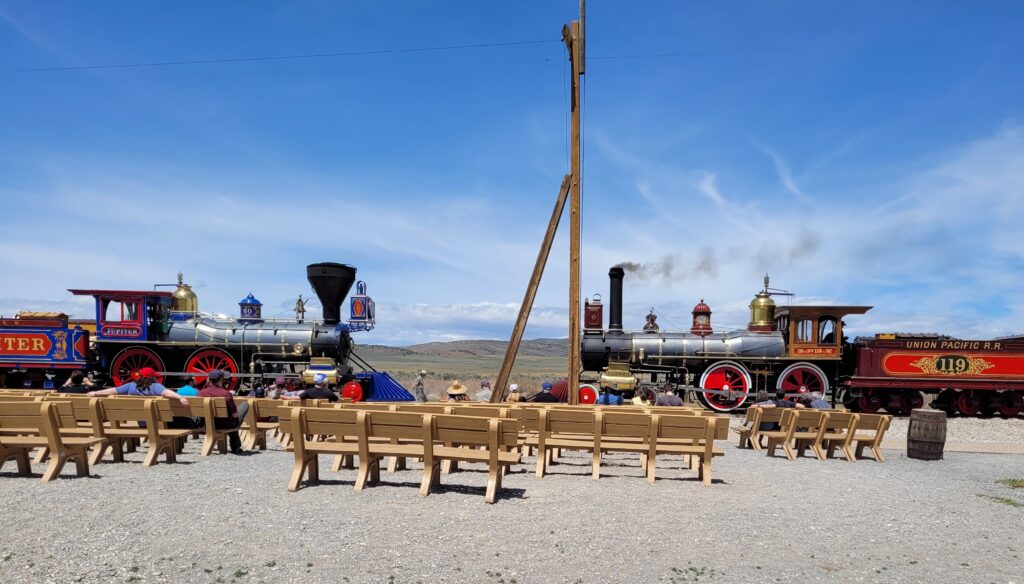
Another day, D.A.’s sister (Irene) and nephew (Chad) joined us for a field trip to Golden Spike National Historic Park about 30 miles east of Brigham City. The park commemorates the completion of the first transcontinental railroad across the United States. Visitor can see the location of the Last Spike Site, 1869 railroad construction features, walk or drive on the original railroad grade, and get an up close view of Victorian era replica locomotives.
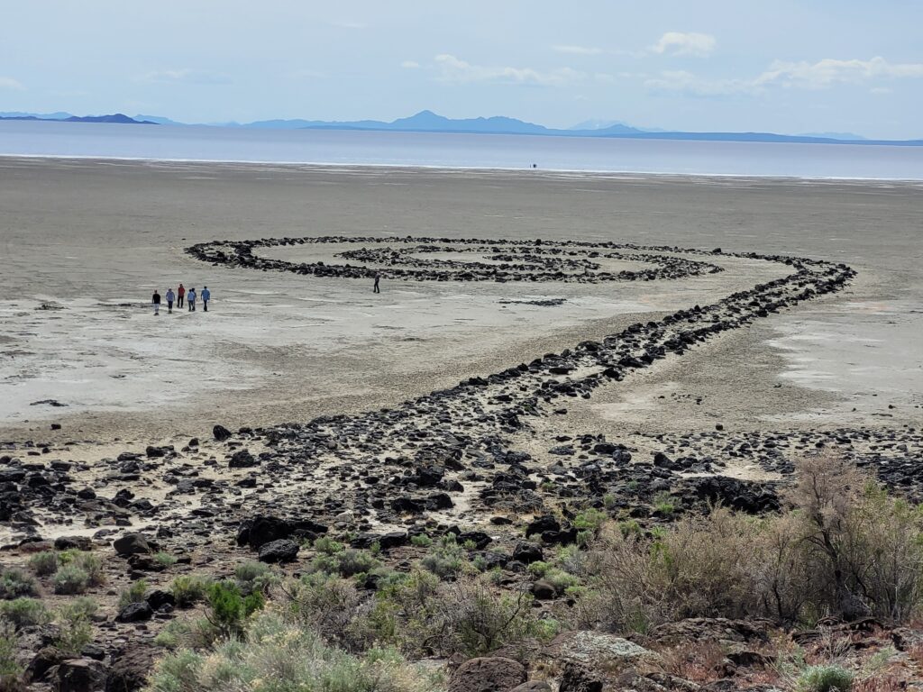
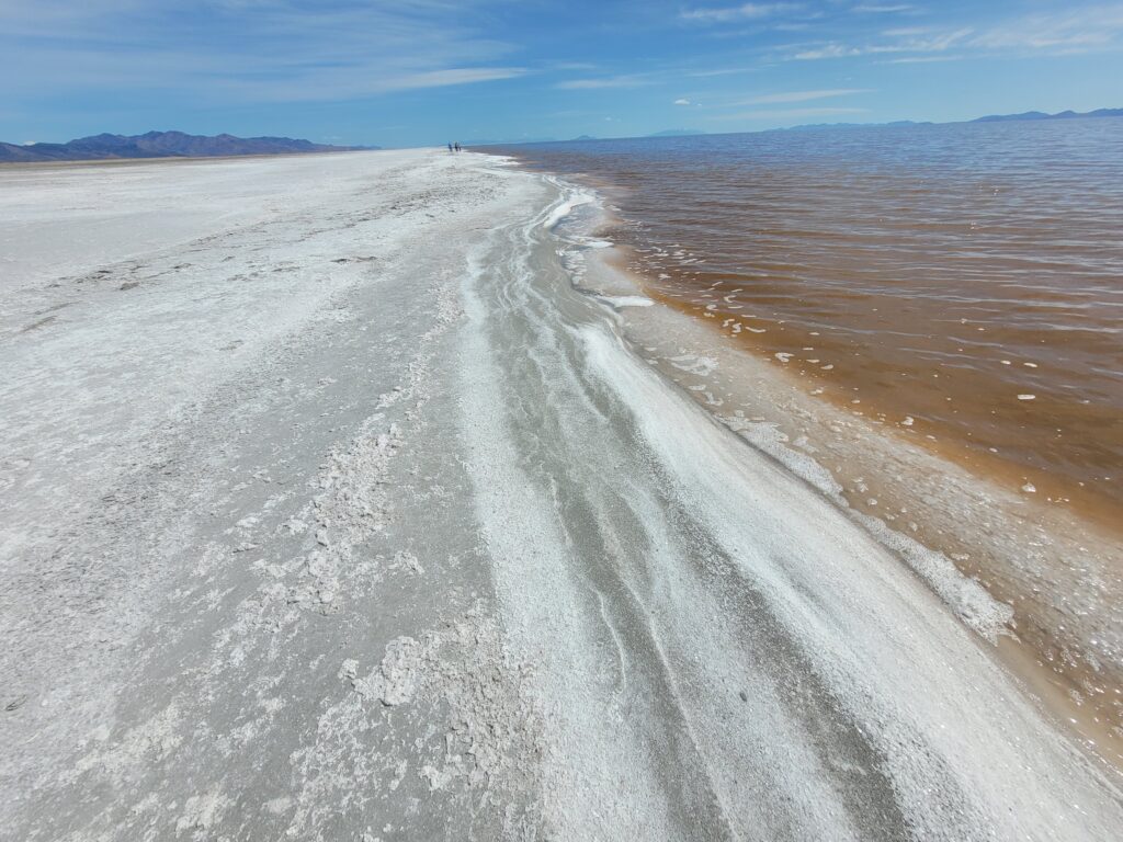
As we arrived, Chad said the Spiral Jetty – a site he had learned about in an Art History class in high school, was only about 15 miles away. He had never been there, nor had we, so when we finished up at the Park, we continued to the jetty.
Back to Wyoming
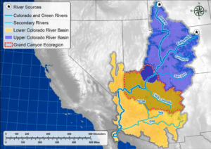
About May 20th, we arrived at Buckboard Marina – our summer home base again this year. Located on Flaming Gorge Reservoir of the Green River (major tributary to the Colorado River), I’ll give you one guess about the issue concerning our neighbors. And you’re correct: dwindling water reserves!
Flaming Gorge is the only reservoir in the Colorado system that has ample water resources. People here are upset – because they have water – that it is being drained. They don’t remember that Flaming Gorge was built (completed in 1964) to supply water to Lake Powell. Flaming Gorge has sent 25 feet to Lake Powell over the past two years and is scheduled to send another 10 feet this water year. (A water year on the Colorado River is May through April of the following year.)
Lake Powell is experiencing Tier 2 conditions and is already cutting back 480,000 acre feet. Estimates to the water level rise in Lake Powell (because of these efforts by both Flaming Gorge and Lake Powell) is 12 to 16 feet.
Wyoming’s Wind River Basin which feeds Flaming Gorge is at 91% of the median snowpack – snow water equivalent. So Flaming Gorge can expect what is called “unregulated flow” from this snowpack. Because nobody knows when it all melts and when it all arrives at the reservoir, Flaming Gorge can experience some increase in inflows that exceed outflows.
Crossing fingers and sending up prayers; we’ll see how it all works out.