A beautiful stop to learn a sad, sad story
My most “mind-blowing” day of the summer was one enroute to Casper. We stopped at “Devil’s Gate,” a gorgeous setting near Independence Rock. We had no idea what we were about to learn. We’d been on this road before, but somehow missed this stop, a historic Oregon-California Trail landmark.
The Visitor Center tells the story of the Edward Martin Handcart Company, a horrible disaster of 1856 that resulted in the greatest loss of life from any single event during the entire Westward migration period.
While many U.S. Mormons had already relocated to Salt Lake City by the 1850’s, the ones traveling with this company were mostly converts from Europe. Many emigrants’ passage was supported by the church, but by the mid-1850’s, drought and famine struck Utah, and suddenly there was not as much wealth in church coffers to support the travels. To save money and time, church leaders in 1856 urged emigrants to use handcarts.
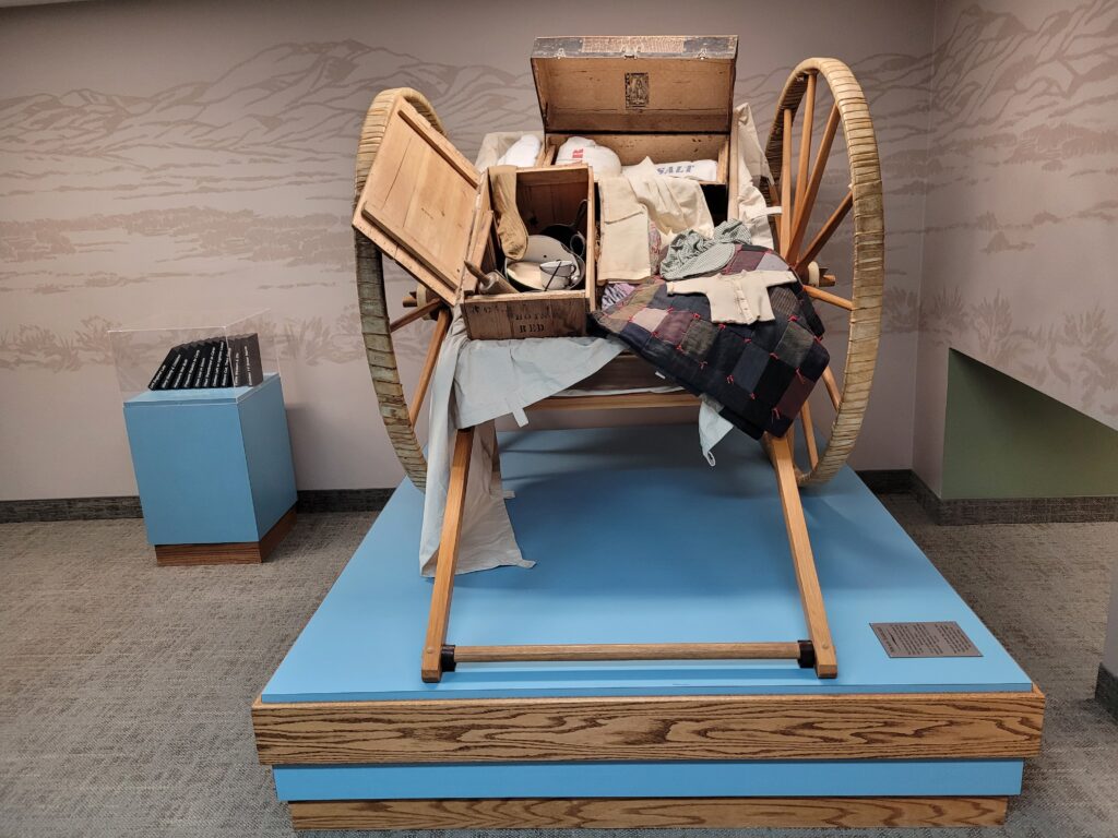
The handcarts consisted almost entirely of green lumber and had been built in Iowa by the emigrants themselves. They were shallow, three feet wide and five feet long, and held skimpy supplies of food, plus 17 pounds of luggage—clothes, blankets, and personal possessions—for each person. A few ox-drawn wagons accompanied the party to carry tents, more food, and sick people. Rations were one pound of flour per person daily, plus any meat shot on the way. The carts were pulled by one or two people while other family members pushed behind or walked alongside.
So, five companies set out from Iowa City traveling to Salt Lake City that summer. Three made the journey without incident. The Martin Company set off from Iowa City traveling to Salt Lake City at the end of July 1856 with 600 emigrants. They did okay until they got into Wyoming in early October, but started suffering from shortened rations and fatigue. They discarded clothing and personal effects in order to lighten the handcarts. They were aware rescue wagons were coming for them and they didn’t want to run out of food or get stalled by winter storms.
On October 19th, while trying to cross the North Platte River near Casper, a winter storm struck
The water was shallow, but the river was wide and freezing cold, so their clothing was frozen on them as they got to camp. It was too late to go for wood and water – the wood was far away. The ground was frozen hard and they were unable to drive tent pins, so they just laid on the ground and waited for morning.
Meanwhile, the rescue company from Salt Lake City was in search of the company, but it took another 10 days to find them. The Martin Company stalled because of the horrible conditions, which sadly resulted in the death of more than 50 handcart pioneers.
Heart-wrenching to see it as presented in this remote spot.
We were having dinner with friends in Casper, but we were actually on our way to Rapid City, South Dakota, so D.A. could renew his driver’s license. We are residents of Wyoming because they are one of a few states that make such a choice a good one. It turns out, though, that if your birthdays are less than six months apart, they let you renew at the same time. Ours, however, are not, so every five years, we make one trip to renew D.A.’s license, then go again the following year to renew mine. If these are the kinds of problems we have, nobody is going to feel very sorry for us! We always try to make it an adventure.
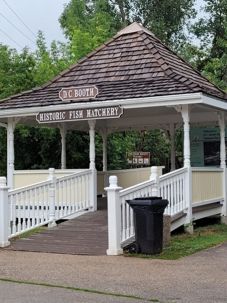
The plan was that we would stop in Spearfish, S.D., to visit the D.C. Booth Historic National Fish Hatchery, a living fisheries museum which also houses the national fish hatchery archives. Heading east on Hwy. 90, it started to rain. By the time we’re close to Spearfish, it was pouring. We decided to pass on the visit. Only a few miles further east, the rain had let up somewhat and there was a road sign for the “Geographic Center of the Nation,” about nine miles off Hwy. 90. Sure, let’s go!
Now, this is a little more complicated than it may seem. The Geographic Center of the Contiguous United States is located about two miles northwest of Lebanon, Kansas. But, in 1959, when Alaska and Hawaii were admitted statehood, the geographic center of the overall United States moved approximately 550 miles! And if that’s not confusing enough, the site we were visiting near Belle Fourche is not the real geographic center, it’s a “public commemoration” site, because the actual center – about 22 miles north – is in private pastureland!!
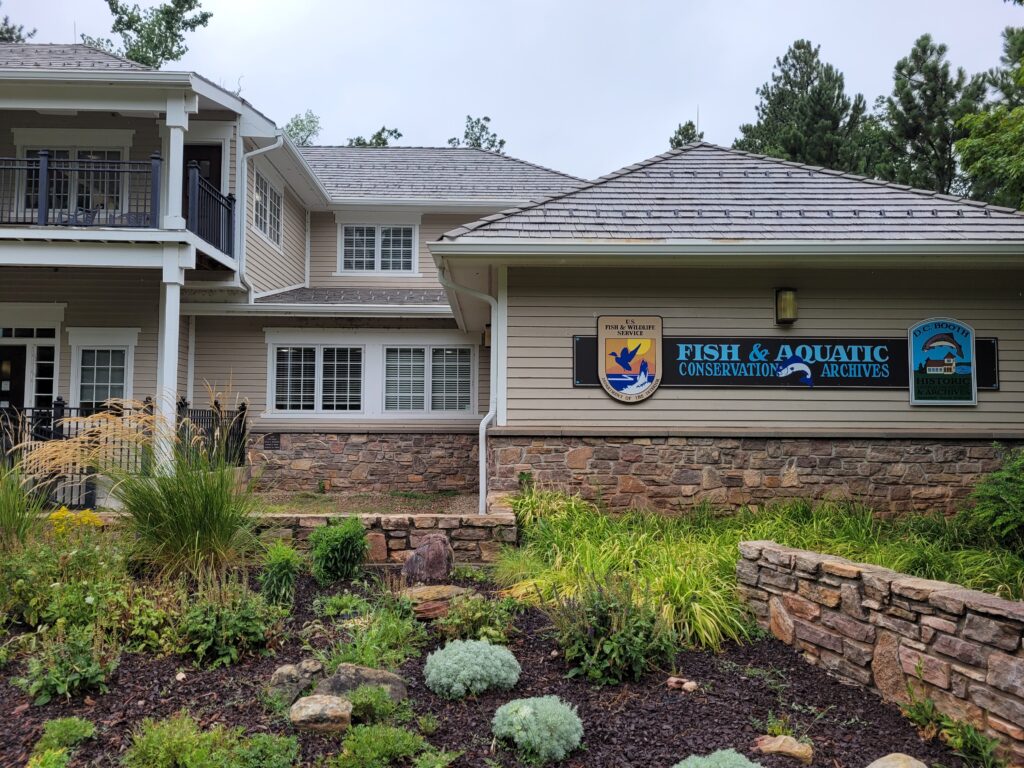
By the time we left, though, the rain was completely over and we headed back to the fish hatchery. Really impressive grounds (and volunteers); it feels more like a museum than a working fish hatchery.
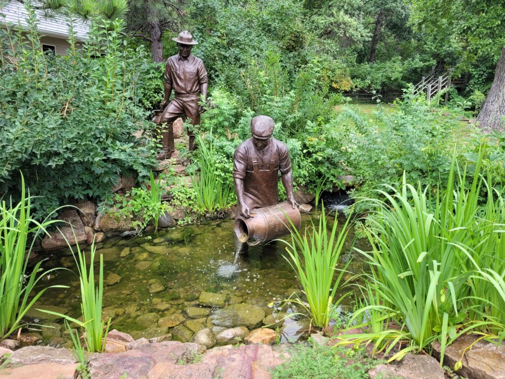
A very interesting aspect was the Fisheries Railcar which tells the story of when fish were transported by rail across the country. Crews actually lived and worked on the cars, delivering fish and stocking lakes and streams.
There were wonderful bronze sculptures by Jim Maher and nature trails throughout the grounds. At the Booth House, living quarters for hatchery superintendents and their families, a docent was waiting and gave us a personal tour through the residence built in 1905.
Absolutely a “must see” if you are visiting the Black Hills. Speaking of the “Black Hills,” do you know how they got that name? I consulted my personal Living History Museum, D.A.: “A Lakota word, Paha Sapa, which means hills that are black.” Seen from a distance, these pine-covered hills appear black.
We were in and out of the licensing office in 10 minutes, then we were on our way back to Casper to spend the weekend with those same friends. We wanted to return by a different route, so Marilyn suggested two meaningful stops: Mammoth Site and Ayers Natural Bridge.
The Mammoth Site
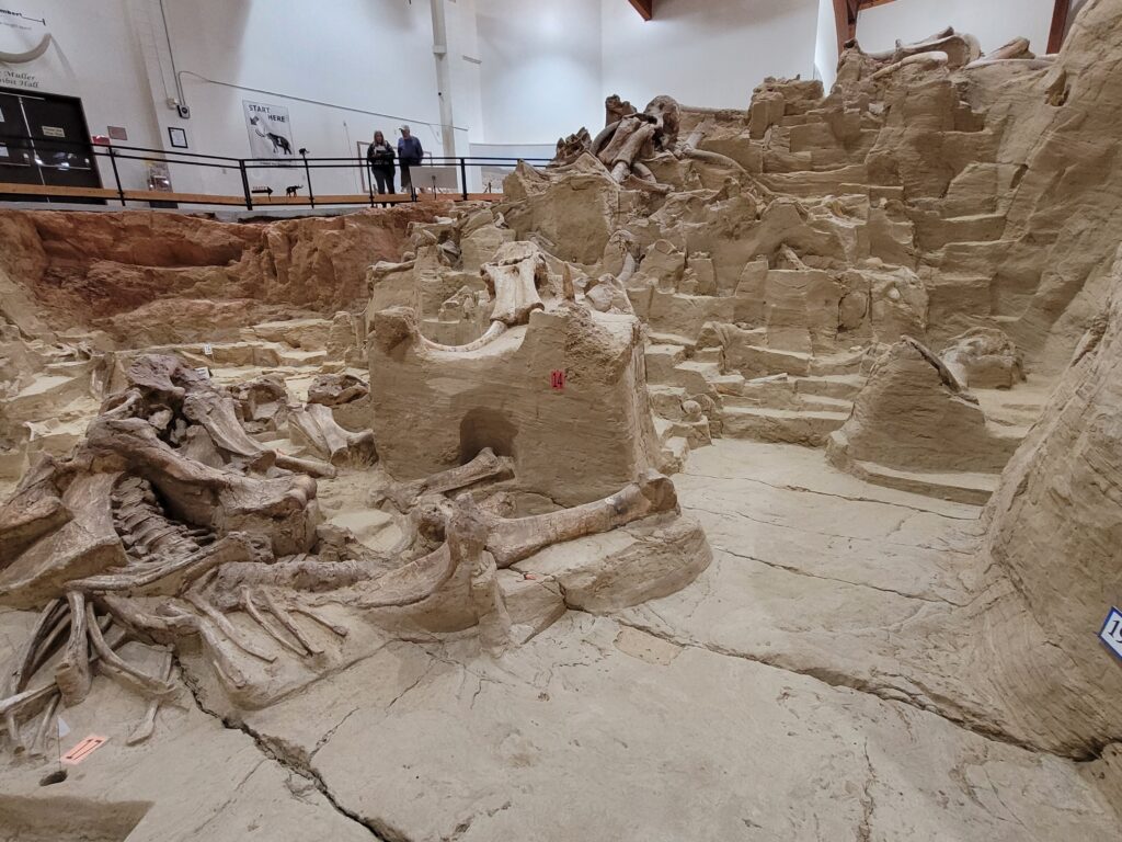
The Mammoth Site in Hot Springs, S.D. – In 1974, when ground was being leveled for a new housing development n Hot Springs, equipment operator George Hanson’s blade struck something that shone white in the sunlight. It looked like a tusk about seven feet long, sliced in half lengthwise along with other bones.
The property was owned by Phil Anderson. He contacted universities and colleges in South Dakota and Nebraska and could find no interest in this discovery!
Mr. Hanson’s son, Dan, had taken classes in geology and archaeology, so Dan contacted a former professor Dr. Larry Angenbroad, who was then on the faculty of Chadron State College in Chadron, Nebraska.
Dr. Angenbroad’s first assessment of the number of bones exposed suggested four to six mammoths. But he felt there had to be more. He involved some of his professional colleagues and they spent 10 days salvaging and stabilizing the bones that were exposed.
Phil Anderson agreed to suspend his project until there was a better idea of what was there.
In 1975, Dr. Angenbroad led a team of volunteer students to begin excavating the site. A complete skull with tusks intact was unearthed. They dug in the summer and then reburied in the winter to preserve them. By the end of 1975, Phil Anderson realized his 14 acres of land would be more valuable as a resource for scientific study than a housing development. Soon, a 501(c)3 Non-Profit Organization, the Mammoth Site of Hot Springs, S.D., was born.
Today, the Mammoth Site of Hot Springs, a National National Landmark, is an active paleontological dig site, which boasts the largest concentration of mammoth remains in the world! The current mammoth count is 61, with 58 Columbian and 3 wooly mammoths.
Fossils of other Ice Age animals have also been discovered: camel, llama, giant short-faced bear, wolf, coyote and prairie dog to name a few. Imprint fossils of bird feathers, complete fish skeletons, and thousands of mollusk shells have also been recovered from this now-dry 26,000 year old sinkhole.
Knowing they would NEVER fully excavate the site, they enclosed and protected it with a climate controlled building. The bones are displayed as they were discovered, in the now dry pond sediments for an “in-situ” exhibit. Walkways allow visitors a close-up view of the fossils.

Another “must see”? Absolutely!
Ayers Natural Bridge
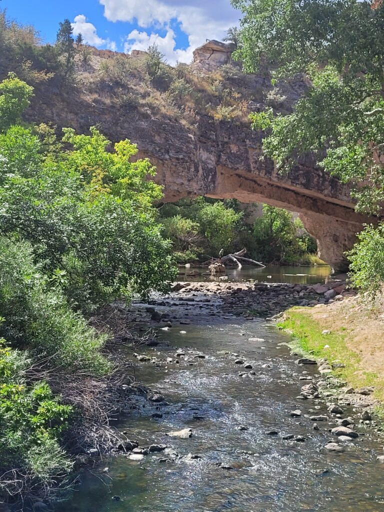
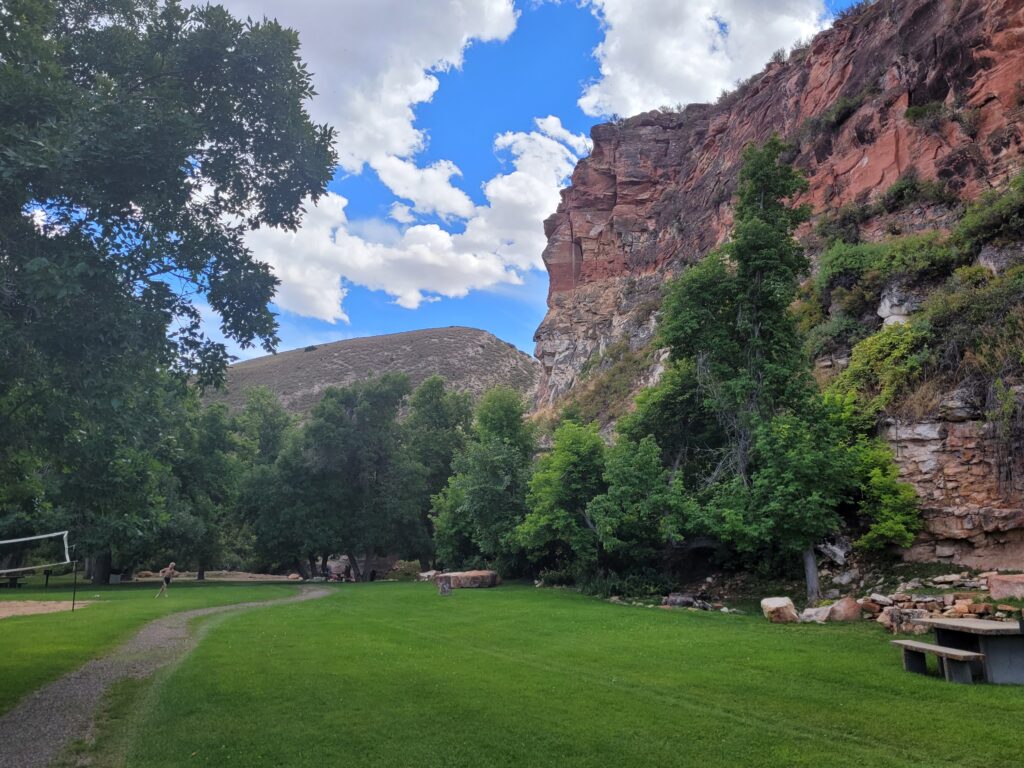
Just west of Douglas, a little south of the Oregon Trail and a few minutes off I-25, Ayers is one of only three natural bridges with water beneath. It is considered one of Wyoming’s first tourist attractions. In 1843, a pioneer described it as “A natural bridge of solid rock, over a rapid torrent, the arch being regular as tho’ shaped by art”. Located in a red rock canyon, the site includes a picnic area, playground, hiking paths, a volleyball court and horseshoe pits. A perfect rest stop on our return to Casper.